
Before St. Louis, there Was Cahokia….The ancient city across the river that America takes for granted
Long before St. Louis became the city of the Arch, long before Illinois became Illinois, and long before the Mississippi River was mapped as a border between states, there was Cahokia.
Not a village or camp. Not a scattered collection of huts. A full city.
Across the river from present-day St. Louis, in-between East St. Louis and Collinsville in the fertile floodplain known as the American Bottom, Cahokia rose into one of the most extraordinary Indigenous urban centers in North American history. At its height around 1100 CE, the site covered roughly 4,000 acres, contained about 120 earthen mounds, and historians believe it was home to nearly 20,000 people.
The official Cahokia Mounds site describes it as the largest pre-Columbian site north of Mexico.
Nearly 20,000 people. WOW. Imagine a sold-out NBA or NHL hockey game; the seating bowl is usually designed for around 18,000–20,000 people.
In the 11th and 12th centuries, that made Cahokia comparable in population to many European cities of the same period. This was not wilderness waiting to be discovered. This was a purpose-built world: planned, organized, ceremonial, agricultural, political and even cosmological.
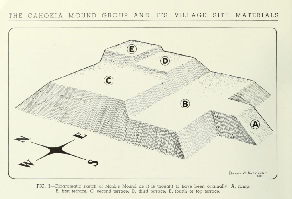
At the center of it all stood Monks Mound, the great earthen monument that still rises from the Illinois landscape today. It is the largest man-made earthen mound in North America, according to Cahokia Mounds’ own site description.
A platform mound is a step-pyramid, meaning centrally-located Illinois is home to pyramids rivaling in size to Egyptian pyramids. Monks Mound, rising 100 feet tall and covering over 14 acres, has a base roughly the same size as the Great Pyramid of Giza. Pretty impressive.
But Cahokia was never just one mound.
It was a city of mounds, plazas, palisades, houses, ritual spaces, roads, alignments, and people. UNESCO describes the site as a “striking example of a complex chiefdom society,” with platform mounds, ridge-top mounds, conical mounds, public areas, residential areas, and specialized activity zones.
Unlike Egyptian pyramids, these are “earthen pyramids” designed with a flat top to support wooden temples or residences for the city’s elite, giving the chosen leaders a spectacular view of the mighty Mississippi and a bird’s eye view of the 4,000 acre mound city. The limestone bluffs of the area simply would not have supplied the kind of rock that would stand up to the test of time.
The slope of the bluff eastward from the mound group is thought to have been an extensive burial ground. The large quantities of human bones and ceremonial burial plots which have been exposed by plows, archeologists and by the washing and wearing away of the earth’s surface dirt, prove that a great population once occupied the fertile land.
This matters because Cahokia forces us to rethink the map.
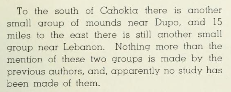
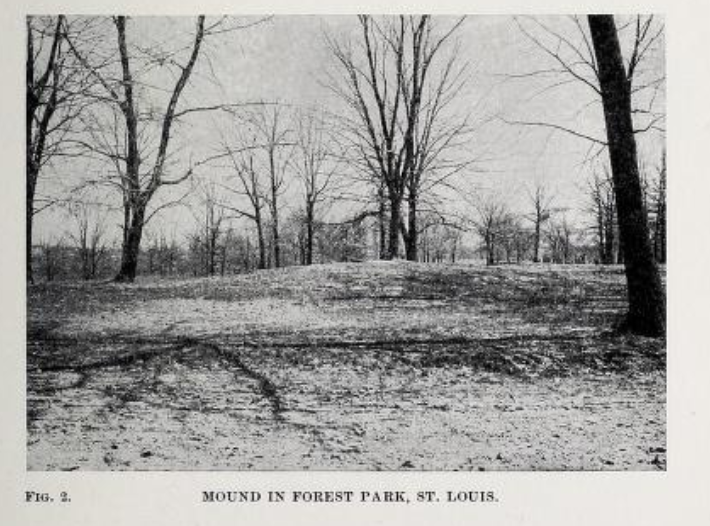
We are used to treating the present-day Mississippi River as a boundary. One side is Missouri. One side is Illinois. One side is St. Louis, and across the way sits the ‘Metro East’. But for the people who built Cahokia, the river was not a dividing line. It was a living artery. And both sides of the river were home to mounds.
The Mississippi River carried food, shell, stone, copper, wood, people, ideas, stories, warnings and power.
A farmer accidently came across a catlinite artifact while plowing and shells from the Gulf of Mexico have been unearthed by archeologists, indicating either that long journeys were made by the prehistoric inhabitants of the valley or that those objects were secured by trade or conquest.
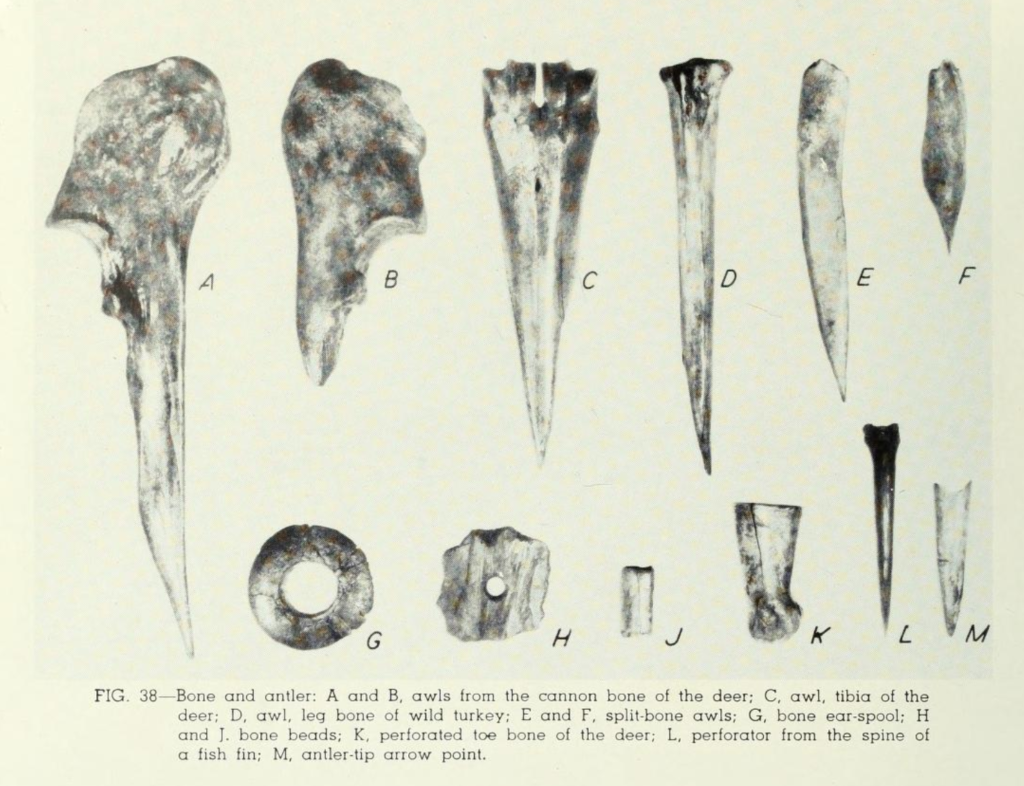
Weapons were often created from animals bones, shown below. Intricate arrowheads were commonly created from rocks and minerals, from the local area and from other geographical areas.
The location was not accidental. Cahokia sat near one of the most important river zones on the entire continent, close to the meeting places of the Mississippi, Missouri and Illinois Rivers. In a world where rivers were highways, this region was not peripheral. It was central.
That is why the story cannot stop at Cahokia.
Travel north along the Mississippi bluffs toward Alton and Grafton, and another old mystery waits above the river: the Piasa Bird, the famous painted monster of the limestone cliffs. Its modern form is a brightly painted, winged and iconic roadside attraction. But the older story is stranger and, perhaps, more frightening.
In 1673, Father Jacques Marquette did not describe one bird. He described two painted monsters on a bluff above the Mississippi. Their eyes were red. Their faces were partly human. Their bodies were scaled. Their tails ended like fish. The name Piasa Bird itself has been translated to mean ‘the beast (bird) that devours men’. A book titled The Piasa, of, The Devil Among the Indians by Hon. P. A. Armstrong states:
“Two immensely large petroglyphs of a monster — or more properly speaking, monsters, for they do not appear to have been alike, though substantially so, as will be seen by reference to the engravings herewith given — were found, first incised or cut upon a layer of bluish gray sandstone overlying a bed of limestone on the north bank of the Mississippi, immediately where the Illinois State prison was built at Alton, Illinois, which were quite distinct when that locality was first settled by the white people, and traces of their outlines remained until the rock whereon they were delineated was quarried by the convicts of the penitentiary as late as about the year 1856. From the mouth of the Illinois river at Grafton to Alton, Illinois, a distance of twenty miles, the Mississippi river runs from west to east, and its north bank or Illinois side is a high bluff, the highest point being the eastern end. This bluff is but a continuous perpendicular strata of limestone, ranging from forty to fifty feet high, with a layer of bluish gray fine grit sandstone, about twenty feet deep, lying on the top or over the limestone, and upon this sandstone, at an elevation of some eighty feet above the base of this ledge of rocks and the river’s surface, these monsters were incised and afterwards painted . They were of about equal size and measured thirty feet in length by twelve feet in height. From their hideous shape and size they were a mortal terror to all the Indian nations of the then northwest. Each nation had one or more traditions connected therewith, some calling them The Piasa, others called them The Piusa. In painting these monsters but three colors were used — red, emblematic of war and vengeance; black, symbolic of death and despair; and green, expressive of hope and triumph over death in the land of dreams, beneath, beyond the evening star, where they located their happy hunting grounds.“
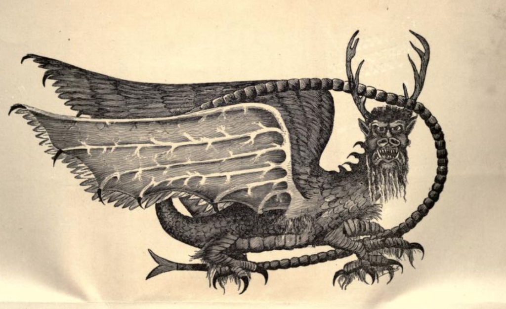
Cahokia and the Piasa Bird are often treated as separate curiosities: one is serious and archaeological, one is folklore and legendary. One a World Heritage Site, one a roadside mural.
But that division may say more about us than about the ancient landscape.
The same river runs between them.
The same bluff-and-bottomland geography frames them.
The same region held mounds, rock art, river danger, spiritual symbolism, oral traditions and later settler mythmaking.
This does not mean historians can claim the Cahokians painted the Piasa Bird. The evidence does not go that far.
But we can say something more powerful and more responsible:
This stretch of Illinois was once part of a dense, meaningful Indigenous landscape, full of life and lore. A place where earthen mounds rose from the floodplain, painted legendary beings watched the river, and the Mississippi moved through the center of everything like a central artery.
The mystery is not whether this region mattered.
The mystery is how much we still don’t know.